Introducing the Jackson School’s 2020-21 Doctorates
June 22, 2021
Please join us in welcoming 16 newly minted Ph.D.s!
During the 2020-21 academic year, a number of Jackson School of Geosciences graduate students successfully defended their dissertations. Kudos to James Biemiller, Hima Hassenruck-Gudip, Ken Ikeda, Eric Goldfarb, Dominik Kardell, Kelly Olsen, Junwen Peng, Son Phan, Evan Ramos, Simon Scarpetta, Natasha Sekhon, Lily Serach, Brandon Shuck, Chijun Sun, Logan West, and Wen-Ying Wu.
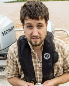
 James Biemiller
Multi-Timescale Mechanics of an Active Low-Angle Normal Fault
The project, defended on November 9, 2020, was supervised by Dr. Luc Lavier and Dr. Laura Wallace with committee members including Drs. Susan Ellis, Demian M Saffer and Omar Ghattas.
Abstract: Detachment faults dipping < 30° commonly accrue 10’s of kms of offset and accommodate a large portion of crustal extension in moderately-to-highly extended regions. Slip on these high-offset low-angle normal faults remains perplexing due to their apparent misorientation relative to Andersonian principal stress directions. Classic fault mechanical theory predicts that normal faults should frictionally lock up and become abandoned at dips < 30°, yet geologic, seismological, and geodetic evidence shows that some low-angle normal faults slip actively. Despite evidence for actively slipping low-angle normal faults, few large earthquakes have been recorded on these structures. The scarcity and low long-term slip rates of active low-angle normal faults make it difficult to determine whether these faults rupture in large earthquakes based solely on seismological or geodetic records. In this dissertation, multi-disciplinary studies of the world’s most rapidly slipping low-angle normal fault are integrated to better understand the structural and tectonic evolution of detachment faults as well as to determine whether these faults slip in large earthquakes or predominantly creep aseismically. Bounding the actively exhuming Dayman-Suckling metamorphic core complex, the Mai’iu fault in Papua New Guinea dips 16-24° at the surface and has been estimated to slip at dip-slip rates of 8.6 ± 1.0 mm/yr to 11.7 ± 3.5 mm/yr. Geodynamic models suggest that weak zones and thermomechanical heterogeneities inherited from a previous subduction phase may have facilitated the formation of this long-lived detachment fault system (Chapter 2). Models of seismic-cycle deformation governed by rate-and-state friction show that the spatial distribution of fault rock frictional stability parameters strongly controls whether low-angle normal faults creep aseismically, slip in periodic large earthquakes, or slip in a mix of episodic creep events and earthquakes (Chapter 3). Surveying and U/Th dating of emerged coral reef platforms along the Goodenough Bay coastline show that tectonic uplift is episodic and imply that this segment of the detachment system slips in infrequent (440 – 1520 year recurrence) large (Mw > 7.0) earthquakes (Chapter 4). Velocities from a newly installed network of densely spaced campaign GPS sites reveal horizontal extension rates of 8.3±1.2 mm/yr (~8-11 mm/yr dip-slip) on the Mai’iu fault (Chapter 5). Laboratory friction experiments on exhumed Mai’iu fault rocks showing depth-dependent transitions in frictional stability help constrain inversions of kinematic models of the GPS velocities indicating that the Mai’iu fault is more strongly locked at ~5-16 km depth and creeping interseismically above 5 km depth. This result suggests that large (Mw > 7.0) earthquakes nucleate downdip of the low-angle portion of the Mai’iu fault and can propagate to the surface along the shallowly-dipping segment and/or more steeply-dipping splay faults in its hanging wall. In contrast to previous studies suggesting that active low-angle normal faults predominantly creep aseismically, this work implies that the active Mai’iu low-angle normal fault slips in infrequent large earthquakes accompanied by some shallow interseismic creep.
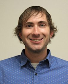
 Logan West
Upper Flow Regime Sediment Gravity Flows in Deepwater Environments: spatio-temporal evolution of deepwater bedforms and the stratigraphy they build
The project, defended on November 16, 2020, was supervised by Dr. Cornel Olariu and Dr. Ron Steel with additional committee members Drs. Mauricio Perillo, Brian K Horton, David Mohrig, and Jacob A Covault.
Abstract: Upper flow regime sediment gravity flows commonly described by the densimetric Froude number (i.e., Froude supercritical flows) are known to generate large ‘supercritical’ bedforms that build and evolve with successive sediment gravity flow events over geologic time periods. To date, expected characteristics of supercritical bedforms and the ability to identify them in the rock record remains incomplete, drawing heavily from physical experimentation and numerical modeling. Physical and numerical studies are highly beneficial but have limitations preventing them from being fully analogous to deepwater systems. This work aims to contribute to supercritical bedform and supercritical fan understanding through a detailed outcrop study, working from deposits out to bedsets and fan architectures. Detailed characterization of beds and bedsets of the Lycium Mbr outcrops in the Fish Creek-Vallecito Basin of southern California, USA reveals a 100 m-thick stratigraphy comprising sets of dozens of conformably aggrading sigmoidal turbidite event beds. Quantitative analysis of these bedsets indicates that deepwater, upslope migrating bedforms systematically preserve bedform geometry and sedimentary textural trends vertically within bedsets that represent the partial or full translation of large-scale, multi-event deepwater bedforms. Specifically, increasing-to-decreasing dip angles of dozens of separate sediment gravity flow event beds typically accompanied by increasing-to-decreasing trends in bed thickness and grainsize are established and tested as reliable indicators of migrating bedform preservation. In the Lycium Mbr outcrops, bedsets are classified into three types based on internal architectures and facies and interpreted to represent different bedforms along the spectrum of supercritical bedforms, namely cyclic steps and antidunes. Recognition and interpretation of bedform types further allows for quantitative constraints to be placed on paleoflow conditions, paleogeography, and relative depositional environments that are consistent with other observed field data. These observation point to a proximal to distal trend from cyclic step-like bedsets to antidune-like bedsets associated with observed decreases in grainsize and loss of any degree of flow confinement. The interpretation of antidunes represents the first recognition of deepwater, multi-event antidunes at scale with modern seafloor sediment waves, with implications for differences in subaqueous flow dynamics and environmental interpretation. This work also establishes that during the time of Lycium Mbr deposition, the Fish Creek-Vallecito Basin was conducive to repeat supercritical sediment gravity flows such that Lycium Mbr deposits can be reliably interpreted as a variant of a supercritical fan. Analysis of the large-scale Lycium Mbr depositional architecture reveals a deepwater fan composed almost entirely of bedforms with only subordinate channelization. The fan is distinctly not composed of sheet sands and exhibits depositional patterns in which deposits young both vertically and proximally as the fan retreats via upslope bedform migration until possible incipient channelization occurring as bedforms encroach toward the possible toe-of-slope helps to facilitate a fan-wide forward step out further into the basin. This pattern (step out, aggrade back, step out) is consistent across the outcrop and supported by other evidence (e.g., grainsize, bedform types, aggradation rates) of forward advance of the fan through time. This behavior and a propensity for abrupt facies changes along relatively short distances (tens of meters) are consistent with experimental expectations of supercritical fan behaviors.
 Dominik Kardell
The Structural and Thermal Evolution of Upper Oceanic Crust in the Western South Atlantic: Insights from Seismic Velocities and Hydrothermal Models
The project, defended November 16, 2020, was supervised by Dr. Gail Christeson and Dr. Sean Gulick with additional committee members Drs. Robert Reece, Marc A Hesse, Luc L Lavier, and Nicholas W Hayman.
Abstract: The evolution of oceanic crust plays an integral role in global heat flow, geochemical cycles, and in shaping the environmental conditions harboring the crustal biosphere. Because oceanic crust is normally buried beneath several kilometers of water and encompasses a vast area of the Earth’s rigid surface, spatially extensive and coherent geophysical data are difficult to acquire in the oceanic domain. Consequently, our current understanding of the evolution of oceanic crust is based on partially conflicting compilations of data that are acquired at different scales and using different methods. Here I present geophysical constraints from an extensive seismic dataset that continuously covers 0-70 Ma crust in the western South Atlantic. Analysis of regional seismic velocity trends in the upper crust shows a continuous increase in basement velocity to crustal ages of at least 58 Ma. This trend indicates an evolution of upper crustal velocities that lasts significantly longer than measured or predicted by previous studies. The results provide evidence for ongoing hydrothermal circulation in relatively old upper crust, which is consistent with heat flow studies. To further test this concept, I used high-resolution seismic velocity models to estimate detailed porosity and permeability distributions that constrain models of hydrothermal fluid flow at five different crustal ages. The resulting advective and conductive surface heat fluxes are consistent with both predictions of heat flux by lithospheric cooling models and measured conductive heat flux at the seafloor. Additionally, computed hydrothermal volume fluxes largely agree with global estimates for the modeled crustal ages. The models are therefore consistent with a “sealing age” of ~65 Ma, which is also inferred from a compilation of global heat flow measurements at the seafloor. Close to the Rio Grande Rise, an oceanic plateau west of the study area, a fine-scale seismic velocity model reveals multiple large fault zones penetrating at least ~1.5 km into the crust. These faults likely accommodate differential subsidence between thickened, warm oceanic plateau crust and cold oceanic crust. Modeled fluid fluxes are elevated along the interpreted fault zones and across the seafloor. Crust adjacent to oceanic plateaus may exhibit elevated levels of tectonic activity and fluid flow globally. The estimated global volume of fluid entering the ocean in this type of setting amounts to 43 km³, which is ~2% of the hydrothermal flux in the axial region. This potentially has implications for global chemical cycles, the hydration of mature oceanic crust, and the oceanic crustal biosphere.
 Junwen Peng
Heterogeneity Characterization and Genetic Mechanism of Deepwater Fine-grained Sedimentary Rocks During Icehouse Period: A Case Study
The project, defended March 25, 2021, was supervised by Dr. Xavier Janson and Dr. Qilong Fu with additional committee members Drs. William L Fisher, Timothy M Shanahan, Kitty L Milliken, and Ronald J Steel.
Abstract: Despite being the most abundant sedimentary rocks and having global economic significance, many uncertainties remain concerning the petrographic, sedimentological, and bulk geochemical signatures of fine-grained sedimentary rocks (i.e., mudrocks) in deep-water environments. A systematic and comprehensive petrographic (chapters 2 and 3), sedimentological (chapter 4), and geochemical (chapter 5) studies of the deep-water organic-rich Upper Pennsylvanian Cline Shale, in the Midland Basin, were conducted in this study to elucidate general principles that can inform synthesis depositional and diagenetic models for deep-water fine-grained sedimentary systems. Multiple high-resolution petrographic techniques applied to mudrocks suggest that primary grain assemblages of the Cline Shale are complex and include both intrabasinal and extrabasinal grains. Total Organic Carbon (TOC), porosity, and permeability of the Cline Shale are proportional to the intrabasinal grains content, whereas rock strength is related to the content of intergranular clay-size microquartz cement (originating from biosilicoeus allochems). The composition of primary grain assemblages is believed to further determine the potential diagenetic pathways and evolution of mechanical and petrophysical rock properties. Detailed sedimentological analysis of three continuous cores from the Cline Shale along the dip direction allows us to define seven lithofacies that stack in a repeated pattern, constituting ~8 to 20 m thick composite cycle sets. The apparent cyclicities recorded in the Cline Shale are interpreted to be controlled by high-amplitude glacioeustatic sea-level fluctuations during a period where the earth was in a ice-house state. High-resolution bulk geochemical analysis revealed significant changes in trace-element enrichment pattern and other bulk geochemical signatures in different lithofacies of the Cline Shale. Such variations in geochemical data were believed to be caused by the variations in benthic redox conditions, primary marine productivity, and hydrographic circulation in the basin, which was interpreted to be associated with high-amplitude and high-frequency glacioeustatic oscillations. This dissertation established a high-resolution imaging protocol for shale petrography (chapters 2 and 3) and confirmed a high-resolution energy-dispersive X-ray fluorescence geochemical technique in mudrock elemental composition detection (chapter 5).
 Simon Scarpetta
Miocene Modernization of the North American Lizard Fauna
The project, defended on April 9, 2021, was supervised by Dr. Chris Bell with additional committee members Drs. Krister Smith, Daniel O Breecker, Timothy B Rowe, David Cannatella, and Travis J Laduc.
Abstract: Terrestrial ecosystems changed substantially during the Cenozoic era. The early Cenozoic was characterized by a warm and wet climate and ecosystems reminiscent of the modern tropics. Plant and animal communities similar to the modern biota were hypothesized to have appeared during the Miocene epoch. The phylogenetic, ecologic, and biogeographic assembly of the modern biota in North America and during the Miocene is well studied among fossil mammals and plants, but is not well documented in ectothermic vertebrates, such as lizards. I employed paleontological, biological, and geological data to address the formation of the modern lizard biota in North America, focusing on pleurodontan lizards (horned lizards, anoles, and relatives) and alligator lizards, which are prominent groups in modern ecosystems. My dissertation comprises three research foci: 1) Descriptions of fossil lizards, primarily from the Miocene but also from the Oligocene and Eocene, to evaluate paleodiversity, paleoecology, and paleobiogeography of focal lizard groups, 2) divergence time estimation using published genetic data and fossil calibrations to temporally constrain the evolution of focal lizard groups, and 3) exploration of fossil identification methodologies, especially fossil diagnoses made in the context of alternative phylogenetic hypotheses. I found one relatively modern lizard fauna from the middle Miocene of Wyoming that corroborates the records of terrestrial plants and mammals. However, I also described fossil occurrences that defy biogeographical (e.g., Abronia from the middle Miocene of California) and ecological (e.g., Uma from the late Miocene of California) expectations based on the biology of living lizards. The fields of historical biogeography and paleoecology draw heavily from the modern biota to make inferences into the past, but I suggest caution in that practice, because the distributions and ecological tolerances of organisms change through time. In the process of diagnosing and identifying a new fossil lizard (Kopidosaurus), I found that attention to phylogenetic hypotheses derived from molecular datasets altered the inferred phylogenetic position of the new taxon. Phylogenetic analyses are a popular avenue among paleontologists for fossil diagnosis, and neglecting alternative phylogenetic hypotheses can hinder fossil diagnosis and all downstream hypotheses that are contingent on accurate fossil diagnosis.
 Ken Ikeda
Frequency-dependent Elastic Properties of Geomaterials: Laboratory Experiments and Digital Rock Physics
The project, defended on April 12, 2021, was supervised by Dr. Nicola Tisato with additional committee members Drs. Mrinal K Sen, Marc A Hesse, Luc L Lavier, Kyle T Spikes, and Beatriz Quintal.
Abstract: Geoscientists often model the subsurface by studying the propagation of seismic waves. As a seismic wave propagates through a medium, its amplitude and phase change according to the medium physical properties. Geoscientists often simplify the rheology of geomaterials to elastic media where elastic properties are frequency-independent. However, geomaterials possess frequency-dependent properties. Such oversimplification can create inaccurate subsurface models. Therefore, often geomaterials should be modeled as frequency-dependent materials using appropriate attenuation models.
In this dissertation, I explore the elastic properties of rocks at low-frequencies (~0.1–100 Hz) and ultrasonic frequencies (105-106 Hz). I use laboratory measurements to estimate elastic properties of rocks. These measurements are then compared to Digital Rock Physics (DRP) results, where the same laboratory measurements are numerically simulated on Computed-Tomographic (CT) images.
The first part of this dissertation explores elastic properties of a quartz-rich sandstone at ultrasonic frequencies. I demonstrate that the laboratory-measured elastic properties could be efficiently predicted using a new DRP based technique called Segmentation-Less withOut Targets (SLOT). The SLOT method uses the local variation of X-ray attenuation in CT-images to map the density distribution of the corresponding material. Numerical simulations of wave propagations are used to estimate the elastic properties of the sample, and show a small mismatch to the laboratory measurements.
The second part of the dissertation focuses on estimating low-frequency elastic properties using the SLOT technique, which has been extended to accommodate the characteristics of a polymineralic carbonate. The modified-SLOT combines segmentation-based DRP with segmentation-less DRP to create elastic property distribution maps. The DRP predictions agree with the laboratory measurements.
The last part of the dissertation shows the development of a new apparatus to measure low-frequency attenuation: the Low-Frequency Module (LFM). The mechanical and electronic design of the LFM is carefully chosen to accommodate a decametric sample that can be tested at reservoir pressure-temperature conditions. The design and the limitation of the apparatus are discussed.
The newly developed DRP techniques and the state-of-the-art apparatus will help geoscientists exploring the elastic properties of rocks at different bandwidths. Improved estimations of elastic properties will help to better capture subsurface features.
- Low-Frequency Elastic Properties of a Polymineralic Carbonate: Laboratory Measurement and Digital Rock Physics
- Calculating Effective Elastic Properties of Berea Sandstone Using the Segmentation‐Less Method Without Targets
 Son Phan
Machine Learning Algorithm for Solving Some Seismic Inversion Challenges
The project, defended on April 16, 2021, was supervised by Dr. Mrinal K Sen with additional committee members Drs. Charles S Jackson, Douglas J Foster, Kyle T Spikes, and Sergey B Fomel.
Abstract: Seismic inversion is a popular quantitative approach to extract some of the subsurface properties from seismic amplitudes by utilizing the physics of the wave propagation through earth layers, in forms of the empirical formulations that simulate the energy distribution phenomenon. Typical inversions are performed with limited offset angles, and in a small time-window, within which the wavelet is assumed to be stationary, and the property contrasts are small across the boundaries. These exposes the process to several major problems: (1) the limited resolution due to wavelet effects, (2) the dependence on some rock physics models when inverting for petrophysical properties, and (3) the resolution discrepancy between the time domain seismic signal and well logs in depth domain. The primary goal of this research is to use machine learning to solve these challenges, by designing and applying proper neural network structures and suitable training schematics. Firstly, a single-layer Boltzmann machine is implemented as an unsupervised learning algorithm to predict the elastic properties at higher resolution than that can be achieved by conventional approaches, while still retaining the physical relationship between the seismic amplitudes and reflectivity series. The high-resolution results are produced from the accurate post-inversion reflectivity series, which is not bounded by the wavelet effects, and novel model update schemes. Secondly, a new multimodal Cross-shape deep Boltzmann machine is designed to simultaneously capture six possible relationships between four different input training data to invert for petrophysical properties from the pre-stack seismic amplitudes in datasets with limited well coverages. This algorithm has a significant advantage in avoiding the uncertainties associated with the data fitting algorithms to create the rock physics models to guide the solution. Last but not the least, a novel multimodal deep learning network is applied to predict the posterior distribution of the subsurface elastic properties from a seismic gather, to resolve the resolution discrepancy challenge, by a smart preparation of the training label in the form of time dependent probability distributions. The biggest advantage of this algorithm is the avoidance of the heuristic calculation of the partition function, which is required to calculate the posterior distributions of common neural network outputs. While the first algorithm requires an input wavelet to constraint the results, the other two algorithms do not, which make them appropriate for inversion in depth domain, or with nonstationary signals.
 Eric Goldfarb
Predictive Digital Rock Physics
The project, defended on April 22, 2021, was supervised by Dr. Nicola Tisato with committee members including Drs. Gary Mavko, Richard A Ketcham, Sean S Gulick, Kyle T Spikes, and Masa Prodanovic.
Abstract: Geophysical surveys are the most effective way to model the surface and subsurface. Recorded signals can only be converted to properties of interest, such as rock type or saturating fluid, if we understand the relationship between rocks and their physical properties. Digital rock physics (DRP) consists of creating digital models of rocks in order to numerically model their properties.
Computed Tomography (CT) scans are a common starting place for DRP models. Each model consists of voxels (3D pixels), with values in units of CT number, which are an approximation of X-ray attenuation in that location. The conventional method of converting CT-numbers into rock properties is known as segmentation. Users assign physical properties to each voxel based off the visually identified material that the voxel represents. Segmentation introduces arbitrariness causing certain rock properties to be drastically incorrect. Measuring some sample properties in the laboratory for calibration is a common mitigation.
Here, we introduce a new segmentation-less DRP method and present case studies suggesting that we can considerably improve the prediction of rock physical properties and match physical laboratory results. Chapter one demonstrates that by scanning objects of known density alongside the rock sample, we can calibrate the rock model. We refer to the method as “predictive”, as sample laboratory measurements are not required. We explain the steps to create density, porosity, and wave velocity models, and derive a method to estimate uncertainty. In chapter two, we acquired CT scans with varying conditions to test the sensitivity of the method. We provide advice and reasoning on how to set up an effective scan. In chapter three, we estimate rock properties from millimetric sized sandstone fragments too small to test with conventional equipment. We also estimate properties for meteorite samples too rare to invasively test. This shows the method is more than academic, and can meaningfully contribute to scientific debate and industry decisions.
We have shown that CT, a relatively new technology not widely adopted for this purpose, can be used to accurately solve rock physics problems when we combine knowledge from material science. This more accurate methodology could make this powerful technology more mainstream for rock physicists.
 Kelly Olsen
Investigating Trench Sediment Consolidation and Upper Plate Structures and their Links to Seismic Behavior Using Active-Source 2D Seismic Data in South-Central Chile and Hikurangi
The project, defended on April 23, 2021, was supervised by Dr. Nathan Bangs with committee members including Drs. Brian K Horton, Luc L Lavier, Harm J Van Avendonk, Jaime D Barnes, and Shuoshuo Han.
Abstract: Subduction zones are convergent margins where one tectonic plate slides beneath another and is recycled into the mantle. Pelagic, hemi-pelagic, and terrigenous sediment deposited onto the subducting plate is off-scraped onto the overriding plate to form an accretionary prism or subduct beneath the overriding plate on top of the subducting plate, where the sediment is either accreted to the base of the upper plate or subducted to at least volcanic depths, or a combination of these processes can occur. Here, I use 2D active-source marine seismic data to create pre-stack depth migrated images and p-wave velocity models to investigate properties of accreted and subducted sediment and examine accretionary wedge and shallow upper plate structures on two thick-sedimented subduction zone margins, the south-central Chile and Hikurangi margin. These two subduction zones have very different seismic behavior; the south-central Chile margin is the location of the largest and sixth largest instrumentally recorded earthquakes, and has a long history of great earthquakes, while the Hikurangi margin has no evidence of very large ruptures, but both deep and shallow slow slip events are observed along this margin. I first examine the south-central Chile margin using 13 seismic transects across the trench and frontal wedge in south-central Chile to investigate along-strike variations in trench sediment properties to understand the partitioning of trench sediment into accreted vs subducted sediment, and link the properties of the subducting sediment to large megathrust earthquakes that have occurred along this margin. I then analyze upper plate structures along the 13 transects, such as thrust and normal faults imaged in the slope sediment, and discuss the relationship between the mechanisms that formed the faults, the stability of the wedge, and how wedge stability may vary throughout the seismic cycle. I then focus on the Hikurangi margin, where the Hikurangi Plateau, part of the Pacific Plate, subducts beneath the Australian Plate. I use three transects across the trench and accretionary prism to investigate differences in sediment consolidation and frontal wedge development due to seamounts on the incoming plate, and discuss potential implications for slow slip events.
 Lily Serach
Elucidating Biotic and Abiotic Controls Over Soil Carbon Stabilization Using Isotope Geochemistry
The project, defended on June 29, 2021, was supervised by Dr. Dan Breecker with committee members including Drs. Timothy M Shanahan, Philip C Bennett, Charles S Jackson, and Timothy Beach.
Abstract: The stability of soil organic carbon (SOC) is one of the largest sources of uncertainty in global carbon cycle models and is central in identifying potential feedbacks to a warming climate. Vertical SOC profiles are used to investigate the spatial and temporal processes involved in the soil carbon cycle. Interpretations of the vertical distribution of SOC concentrations, radiocarbon (¹⁴C), and stable carbon isotopes (δ¹³C) provide key information on carbon cycling processes in the soil. When these profiles are considered alongside flux of CO₂ out of the soil surface into the atmosphere, vertical trends in soil pore space CO₂ concentrations and the associated isotopic values (both stable and radiogenic), one can develop empirically-derived narratives on soil carbon dynamics at a slice of time in a soil. We can use models to the simulate development of these vertically resolved trends through time and therefore investigate the cumulative effect of different soil carbon cycle processes that ultimately result in the trends we observe. The goal of this dissertation research is to elucidate the key processes involved in SOC stabilization in forest soils using high resolution profile data and different numerical modeling techniques. The first chapter of this dissertation focuses on advancing the understanding of how carbon is transported to deeper depths in the soil, which is important for elucidating how stable SOC forms and persists through time, and what type of data are necessarily for reducing uncertainty in the model parameters used to represent various soil carbon cycle processes. The second chapter this dissertation focuses on the relationship between observed δ¹³C and C concentration profiles in well-drained forest soils. The third and final chapter of my dissertation involves another 1D reactive transport model to estimate the contribution of anaplerotic CO₂ fixation to observed trends in δ¹³C, Δ¹⁴C, and soil respiration rate in soils from 3 terrestrial biomes: boreal, temperate, and tropical. This chapter aims to quantify a potential Δ¹⁴C reservoir effect due to anaplerotic soil CO₂ fixation and determine the extent that the direct assimilation of soil CO₂ into microbial biomass contributes to the formation of soil organic matter as well as the formation of more stable SOC. Overall, the research and results that comprise this dissertation highlight the utility of soil profile data in understanding the long term cycling of carbon through the soil, and underscore the importance of key processes such as vertical transport of less labile SOC, the PCO₂ effect on C₃ plants, and anaplerotic soil CO₂ fixation in our understanding of how soil organic matter forms. A better understanding of these processes and the extent that they occur in different soils will inform interpretations of Δ¹⁴C and δ¹³C data and could help to predict the response of stable SOC to a changing climate, particularly in high-latitude soils.
 Brandon Shuck
Mechanisms of Lithospheric Failure During Late Continental Rifting and Early Subduction
The project, defended on July 1, 2021, was supervised by Dr. Harm van Avendonk and Dr. Sean Gulick with committee members including Drs. Donna Shillington, Nathan L Bangs, Thorsten Becker, and Luc L Lavier.
Abstract: To be added
 Evan Ramos
Toward a Mechanistic Understanding of Silicate Weathering and Li Transfer Across Landscapes, Past and Present
The project, defended on July 1, 2021, was supervised by Dr. Jaime Barnes and Dr. Dan Breecker with committee members including Drs. Brady Foreman, Joel P Johnson, and Daniella M Rempe.
Abstract: Silicate weathering is a fundamental process that sculpts landscapes, provides nutrients for organisms, underpins life-sustaining biogeochemical cycles on Earth, and keeps Earth from entering a runaway greenhouse state. This process is influenced by the geologic and environmental conditions at the Earth’s surface, therefore uniting many traditional geoscience subdisciplines and being an area of active research for nearly a century. It has been studied through observations of drainage catchments on continents, where most silicate weathering on Earth happens today. The geologic record also served as an important archive of this process, invariably recording the conditions and processes occurring at the Earth’s surface in the past and allowing for observations on timescales that studies of modern environments do not permit. Despite advancements in the process-based understanding of silicate weathering, considerable debate remains regarding its primary drivers, the relevance of silicate weathering in the evolution of Earth’s climate, and the degree with which known modulators of silicate weathering can be constrained independently of one another. The central focus of this dissertation is to expand upon the utility of lithium (Li) isotopes: a burgeoning isotope system that, when measured in geologic material, allows for a quantitative assessment of silicate weathering over a range of timescales. The dissertation is composed of three case studies which test the viability of Li isotopes in discerning the controls of silicate weathering, both in past and present environments. In turn, these studies help identify controls of silicate weathering in different Earth surface environments. The outcome of these studies are conceptual or mechanistic models for silicate weathering that either i) provide constraints for its controls or ii) yield a template with which to probe it with Li isotopes and other measurements.
 Wen-Ying Wu
Advancing the Application of Remote Sensing to Improve Land Surface Modeling
The project, defended on July 21, 2021, was supervised by Dr. Zong-Liang Yang with committee members including Drs. Bridget R Scanlon, Bayani Cardenas, and Daniella M Rempe.
Abstract: Over the recent two decades, space agencies have put enormous effort into remote sensing for understanding the global water and energy cycles. Our understanding of global hydrology has advanced in this golden age of satellite hydrology. This dissertation explores the global to continental- scale applications of multiple satellite missions for Earth system models to understand land-surface processes.
Data assimilation is a novel approach to integrated satellite observations and models to provide continuous and more realistic estimates. In Chapter 2, I investigate impacts of land data assimilation (DA) on runoff and streamflow. Multiple experiments with the assimilation of different combinations of remote-sensing datasets are conducted using the Community Land Model version 4 (CLM4), constrained by assimilating observations from the Moderate Resolution Imaging Spectroradiometer (MODIS), Gravity Recovery and Climate Experiment (GRACE), and Advanced Microwave Scanning Radiometer for EOS (AMSR-E). Results show GRACE-DA dominants runoff, and snow-DA-induced runoff are pronounced in high and mid-latitude. GRACE-DA improves the spatial pattern of streamflow during summer and autumn. This study shows how data assimilation help improve streamflow estimation.
Satellite observations are used as benchmarks for diagnosing model performances in Chapter 3. Results show a systematic cold bias over drylands in the latest Coupled Model Intercomparison Project Phase 6 (CMIP6) simulation, associated with overestimated evapotranspiration cooling. The aridity-dependent biases in skin temperatures show modeled deficiencies in land-atmosphere interactions. Results suggest a higher priority to develop and improve related processes to eliminate temperature biases in state-of-art climate models in dry conditions.
Predicting droughts is a great challenge of climate models. In Chapter 4, we investigate the physical process that controls water availability during drought to understand the mechanisms causing the disparities. Results suggest that using different physical parameterizations, such as considering vegetation response, affect water availability but also skin temperature through the modulation of evapotranspiration.
The studies presented in this dissertation demonstrate the applications of satellite information in the field of large-scale climate modeling as data assimilation, benchmarking, and data inputs. Emerging challenges are shown and shed some light on the future research direction of global hydrology.
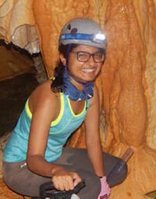 Natasha Sekhon
A monitoring and 20th stalagmite study from a shallow cave in New Mexico elucidating climate controls on geochemical variability with insight into stalagmite suitability for paleoclimate reconstructions
The project, defended on July 23, 2021, was supervised by Dr. Jay Banner and Dr. Dan Breecker with committee members including Drs. Bryan Black, Yuko M Okumura, and Timothy M Shanahan.
Abstract: Confronting climate change with a delayed onset of the Monsoon season and an increase in anthropogenic aerosol concentrations is the new normal. In water-scarce regions such as New Mexico, that rely on rainfall during the summer season, there is a strong concern on how water resources will be affected by future climate change enhanced due to increase in greenhouse gases. Paleoclimate studies offer a lens through which to better prepare for future climate scenarios by investigating trends in pre-instrumental paleoclimate data. However, a thorough understanding of how climate variables are reflected in the geochemistry of paleoclimate data is required. Further, sub-annually resolved paleoclimate data are essential to delineate seasonal variability. The geochemical variability of stalagmites harvested from near cave entrances preserve sub-annual climate variability. Further, the geochemical variability from 20th century sub-annually stalagmite records can serve as important links between cave-monitoring and longer stalagmite records. Through monitoring a shallow cave in New Mexico (Sitting Bull Falls Cave), we document seasonal variability in Mg concertation of modern cave calcite to reflect variability in surface-air temperature. We next investigate the controls on the geochemical variability of two 20th century growing stalagmites retrieved from the same cave. To retrieve an age model, we develop a depth-to-age peak counting algorithm using the temperature-dependent variation of calcite Mg concentrations. We next qualitatively compare the sub-annually resolved time series against instrumental data of rainfall, wind speed, and aerosol deposition to ascertain seasonal trends. We find that Fe concentrations increase during the Monsoon Season (July-September). Zn and Cu concentrations increase during the pre-Monsoon season, which we infer to record aerosol deposition. Finally, we use XRCT scans to reconstruct the internal growth morphology of a new core in Sitting Bull Falls cave with the aim to retrieve a record that pre-dates the instrumental record. The result from this research demonstrates that increase in transition metal concentrations reflect season of recharge (Fe) and aerosol deposition (Zn). This relationship between proxy and climate variable should be consistent in stalagmites from other regions. And stalagmites that pre-date the instrumental can potentially reconstruct the variability in groundwater recharge and delineate between natural and anthropogenic deposition.
 Chijun Sun
Hydroclimate Changes Over the Great Plains Since the Last Glacial Maximum
The project, defended on July 30, 2021 was supervised by Dr. Timothy Shanahan with additional committee members Drs. Dan Breecker, Terry Quinn, Pedro DiNezio, and Judson Partin.
Abstract: The weather extremes associated with mesoscale convective systems (MCSs) over the Great Plains have substantial socio-economic impacts on the regions’ diverse and growing society. It remains unclear how anthropogenic warming will affect the climate of this region in the future due to large uncertainties in simulated precipitation changes by climate models and a lack of knowledge about the long-term variability of these storms. This dissertation seeks to improve our understanding of the climate dynamics of the Great Plains, focusing on using past changes in MCS activity and hydroclimate to understand their responses to external forcings. To do so, I generate a 20,000-year record of MCS activity and hydroclimate in central Texas using the D/H ratios of sedimentary leaf waxes coupled with trace element analysis and carbon isotope composition of bulk organic matter. To improve our confidence in the interpretation of hydrogen isotope data, I first investigate the meteorological controls on the isotopic composition of precipitation in the Great Plains, which suggests that the isotopic ratios of rainwater mainly reflect the magnitude of the dominating MCS storms over this region, with larger and stronger MCSs producing more negative isotopic values and vice versa. Based on our improved understanding of the regional isotope systematics, our multi-proxy record shows pronounced responses of MCS to external forcings (i.e., retreating ice sheets, solar insolation) on orbital to centennial timescales. Results from transient climate model simulations indicate that variations in the intensity of the Great Plains Low-Level Jet in response to springtime land surface warming can account for these changes in MCS activity. Differential springtime warming over the continent and the North Atlantic drives steeper zonal temperature and pressure gradients over the Great Plains, intensifying the Great Plains Low-Level Jet which consequently enhances the magnitude of Great Plains MCSs via increased moisture availability. These results provide important implications for the potential responses of Great Plains MCS activity to anthropogenic warming, where more pronounced land surface warming relative to the ocean may dynamically intensify future storms with increased risks for extreme weather in the Great Plains.
 Hima J. Hassenruck-Gudip
Understanding Fluvial Topography: Morphodynamic Processes that Build River Levees and Cut Terraces
The project was supervised by Dr. David Mohrig.
Abstract: Floodplains capture extreme events on a river when water overtops associated riverbanks. As a river migrates, floodplains adapt to feedback in topography, sediment availability, and flow conditions. Describing how floodplains evolve will improve estimates of sediment, organic carbon, and nutrient storage and help predict changes to a stockholder’s river-adjacent land. This dissertation focuses on pathways between a river and its floodplains as terraces form and as natural levees evolve. Terraces form when floodplains are elevated above the active river due to changes in base-level or water to sediment discharge ratios. Natural levees comprise one of several constructional topography styles separating a river channel and its floodplain. As such, levees regulate the exchanges of solids, solutes, and flow between the river and its overbank surface. First-order questions exist about the amount of sediment transported to the floodplain and flow characteristics that natural levees preserve. The improved resolution provided by airborne lidar has enabled systematic studies of terraces formation and natural levees on the coastal Trinity River, Texas, highlighted below. This dissertation analyzes how floodplains are abandoned as terraces and how modern natural levees are formed on floodplains. In Chapter 2, proxies developed to describe both elevation variations and paleo-channel characteristics preserved on late Pleistocene terraces that confine the modern valley. Results show the abandonment mechanism varies for different terrace sets. In the remaining chapters, I combine high-resolution topography measurements, changes observed with repeated measurements, and field observations to quantify natural levee topography and describe how natural levees evolve. I show a first-order morphodynamic correlation between levee crest elevation and river hydraulics and between levee width and topographic floodplain lows. I further show that the percentage of banks with natural levees increases in the most ocean-ward reach. Levee channels are vital in transporting sediment to the levee-floodplain boundary as bedload transport building out into Gilbert-type deltas in standing water. Lastly, I use a framework that integrates across scales from the grain size to the entire >150 km river reach to show how water flow and sediment transport contributes to levee-scale depositional patterns.
Compiled by Kristin Phillips, Department of Geological Sciences