Remote Sensing
Remote Sensing
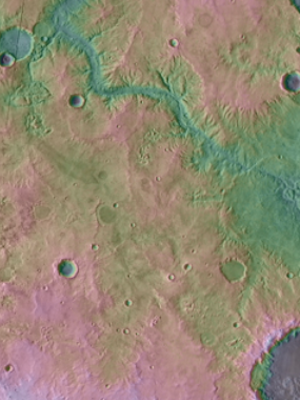
The Planetary Surface Processes Group uses remote sensing to study Mars, Earth, and other planets. Equipment that enables this research includes a dedicated server, >100 TB of storage, and high-end desktop workstations for processing, storing, and analyzing satellite remote sensing datasets. The group also has multiple drone systems for acquisition of remote sensing data, including lidar and images (for Structure from Motion).
- Contact Timothy Goudge for details.
Tx DRONE Laboratory
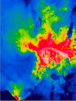
The Texas Digital Remote Observation and Education Laboratory (Tx DRONE) facility includes a large fleet of drones, or UAVs with traditional or thermal infrared cameras attached. Geospatial software to produce SfMs is included in the data processing capability.
- Contact Daniel Stockli and Timothy Goudge for details